
Morton Grove ZIP Directory Coverage
Official Village contact pages and the 2026 resident handbook identify 60053 for Morton Grove. No additional ZIP serving a Morton Grove street or unit was verified in the official material reviewed. That gap matters: nearby postal codes should not be added merely because neighboring communities touch the village. Run the USPS tool for the exact delivery address before extending this ZIP code directory.
| ZIP | Areas Covered | Post Office | Notes |
|---|---|---|---|
| 60053 | Morton Grove locality and Village contact addresses verified in Village sources | Morton Grove Post Office, 9114 Waukegan Road | Exact delivery exceptions require USPS address lookup |
| Additional service ZIP | Not verified in official sources | Not located | Do not infer from an adjacent town |
The Morton Grove Post Office phone is 847-965-1621. A station address proves the station's postal location, not that every parcel inside or near the village shares identical delivery fields. Nor did the research confirm a split, realignment, or historical change year. The defensible ZIP code directory records that limit instead of filling it with guesses.
Verify a Morton Grove ZIP Code
The USPS ZIP Code Lookup is the authority for current delivery formatting. Enter the exact house number, street, unit when present, city, and state. Save the standardized address and returned postal code with the lookup date. A city-and-state search may introduce possible postal localities, but an exact-address result is the stronger check for a particular Morton Grove home.
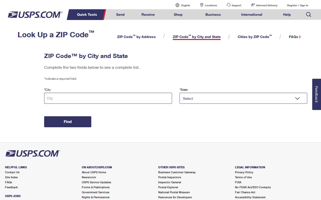
The captured USPS screen supplies the official starting point for ZIP verification. It does not, by itself, settle village limits, township, school district, court route, or parcel identity. Those checks belong to county and Village systems.
Search tip. Preserve the USPS-standard address, but also keep the original wording because older records may index the same place differently.
Find Morton Grove Residents by ZIP
Two verified official interfaces use a ZIP field in different ways. The Cook County Property Tax Portal accepts ZIP with an address search, helping compare the situs address, which is the parcel location, with tax-bill mailing context. The Illinois voter status tool requires a five-digit ZIP before it reveals the street-number and dynamic street-name steps. Neither interface is a public ZIP-wide roster.
- Confirm the delivery address and five-digit code through USPS. Keep standardized and original street forms.
- Search the Cook County Tax Portal by address and ZIP, then record the PIN, city field, mailing context, and source date.
- Use the Assessor or CookViewer with the street address or PIN. These verified searches do not require ZIP.
- For a known person, enter the ZIP with name, birth date, street number, and selected street in the voter status tool.
- Compare township, village, and school layers in official maps before treating a postal match as a jurisdiction match.
A ZIP code narrows delivery geography but does not produce a list of everyone at an address. Once research narrows to a named road, the Morton Grove street directory owns the parcel-by-parcel method.
Morton Grove ZIP Search Fields
Portal behavior explains many false negative results. The standard Assessor address form asks for house number, direction, street name, and city, but not ZIP. CookViewer searches by address, PIN, or intersection. A postal mismatch may therefore leave a valid parcel result intact. By contrast, an incorrect ZIP can block the voter sequence, and the Tax Portal uses ZIP as part of its address form.
| Official source | Verified input | ZIP behavior |
|---|---|---|
| USPS | Street address, city, state | Returns current standardized delivery code |
| Property Tax Portal | Address and ZIP | Uses ZIP in property search |
| Illinois voter lookup | Name, birth date, ZIP, street number and name | ZIP is required before street steps |
| Cook County Assessor | House number, direction, street, city | No ZIP in standard address form |
| CookViewer | Address, PIN, intersection | Verified instructions do not require ZIP |
Record which field failed. “No result” from the voter lookup after a ZIP mismatch does not mean no registration exists. An Assessor match with a different postal form may still identify the correct parcel, but USPS should confirm delivery details.
Morton Grove ZIP and City Limits
Postal city and municipal boundary are separate facts. Morton Grove borders Niles to the west and south, Skokie to the east, and Glenview to the north. Official sources also describe the village as either 5.09 or about 5.2 square miles, a source-vintage or measurement difference that should remain visible. Neither figure defines the 60053 delivery boundary.
The village lies in Cook County but spans Maine and Niles Townships. That split can change the proper election, tax, school, court, or archive route. Harlem Avenue provides a useful school-geography check: Village material sends the east side to Niles Township High School information and the west side to Maine Township High School information. School geography still does not establish a ZIP result.
- ZIP versus ZIP+4
- A five-digit ZIP routes a broad delivery area. ZIP+4 narrows delivery to a smaller segment, such as part of a block or building.
- PO-box ZIP
- A postal code designated for post-office-box delivery rather than ordinary street delivery.
- Unique ZIP
- A code assigned to one large organization or delivery recipient. None was verified for Morton Grove.
- Carrier route
- A postal delivery path used to group addresses for a carrier, not a municipal boundary.
Note: A 60053 result confirms postal routing only; pair it with an official parcel and boundary source before stating government jurisdiction.
Morton Grove's Two-Township Split
The Maine and Niles Township split is the key geography interest layer for this ZIP code directory. A search limited to one township can miss an otherwise valid Morton Grove address. County property sources, election districts, school information, and local archive descriptions may all use the township field even when the mail reads Morton Grove, IL 60053.
Use the Village maps and Community Portal for address-based service and district layers. Then compare CookViewer's parcel and district layers. Keep the village, township, county, school district, and ZIP in separate columns. A clean research note can hold all five without forcing them into one boundary.
This distinction also protects against same-street errors near village edges. A postal locality can be useful search text, but the mapped parcel and legal description decide the land identity used in county records.
Bridge Morton Grove ZIP Mismatches
A Cook County PIN is a 14-digit parcel identification number, usually displayed in dashed segments. It is more stable than a casual street spelling, although a parcel split or consolidation can create a new PIN. Legal descriptions may identify a subdivision, lot, block, tract, or metes-and-bounds boundary without using the familiar street name.
Use the Cook County Assessor address search to locate a PIN, then open CookViewer by address, PIN, or intersection. Compare the parcel against the Property Tax Portal, which can show mailing and recent-document context. If the postal code differs, return to USPS rather than editing a county field to make it agree.
The legal description is especially useful for an old deed, changed unit, or street wording that no longer matches a modern form. Preserve it exactly. It bridges land records without pretending that the historic and current postal systems used the same labels.
Historical Morton Grove ZIP Gaps
No official source reviewed established a Morton Grove ZIP split, realignment, or added service code. Old directory entries can predate ZIP codes or abbreviate the locality. The 1960/61 suburban White Pages, for example, uses “Mortn Grv” in a verified sample. That printed locality belongs to its source date and should not be silently expanded into a modern postal conclusion.
For older records, preserve the printed address and locality abbreviation. Compare the directory page with a dated map, parcel legal description, and current PIN only after noting the time gap. Historical Sanborn maps and telephone books can locate a building or household in their own period, but they do not establish today's ZIP code or present resident.
Research should state the gap plainly: 60053 is verified in current Village material, while other coverage and change dates remain unverified. That is more accurate than importing adjacent ZIP codes from a general list.
Read Morton Grove ZIP Results
A strong ZIP research card records the source URL, lookup date, standardized street and unit, postal city, ZIP and ZIP+4 when returned, village status, township, Cook County PIN, and any map or legal-description reference. Each field keeps its provenance. If two sources disagree, report both and note which authority controls the question.
| Field | What It Identifies | Morton Grove Caution |
|---|---|---|
| Postal city | USPS delivery locality | May not equal municipal jurisdiction |
| Village | Municipal service boundary | Uses local parcel and address layers |
| Township | Civil, tax, election geography | Morton Grove spans Maine and Niles |
| PIN | County parcel identity | Can change after split or consolidation |
| Legal description | Recorded land identity | May omit the street name |
Use the least personal data needed. A ZIP code directory is a geography tool, not proof of who occupies a home. Official parcel, voter, and postal results each retain their own access and privacy limits.